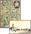
The map of the eastern part of Poland.
Italy. 17th century.
Copperplate engraving, watercolor.
Rag paper.
Off-print: 61 x 46 cm.
Sheet: 71.5 x 50 cm.
Compiler: Cornaro Federigo
|
Here you can order catalogue of exhibition
"Maps and views of Russia. The exhibition of engravings and lithographs. 17th—19th centuries."